Remote Sensing Laboratory (RSL)

Remote Sensing Laboratory (RSL)
The NNSS’ Remote Sensing Laboratory (RSL) is the center for the design, development, fabrication, and utilization of detection instruments. Science and technology areas include:
- Development of software, hardware, and methodologies for emergency response programs
- Advanced operational techniques
- Support of counterterrorism and radiological-incident response
- Site-directed research and development
Emergency Response Capabilities
RSL supports the following assets with deployment and home team operations:
- Counterterrorism and Counterproliferation
- Nuclear Search Program (NSP)
- Aerial Measuring System (AMS)
- Radiological Assistance Program (RAP)
- Joint Technical Operations Team (JTOT)
- Nuclear Search Program
- National Search Team
- National Capital Response
- Maritime Support Team
- Search Home Team
- Nuclear Radiological Advisory Team
- Consequence Management
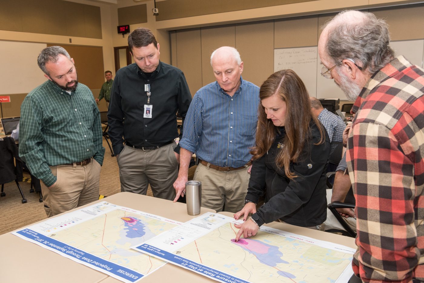
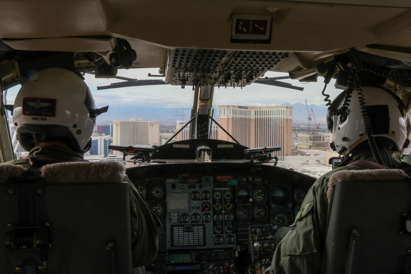
RSL has several crisis response and consequence management emergency response teams specially trained and fully equipped to respond to a variety of radiological situations, including nuclear power plant accidents, nuclear terrorist incidents, NASA launches, and transportation events. Located at Joint Base Andrews in Maryland and Nellis Air Force Base in Nevada, the RSL is on call 24 hours a day, seven days a week, and can provide rapid deployment of these emergency response assets to anywhere in the country in just a few hours. The teams can also deploy internationally to support outside the continental United States (OCONUS) operations anywhere in the world.
As part of its emergency response, RSL provides:
- Deployable crisis response and consequence management assistance
- Emergency communications network
- Home team support to RSL teams, Render Safe assets and other federal, state, tribal and local organizations
- Logistics and operations support
- Training and exercise planning and execution
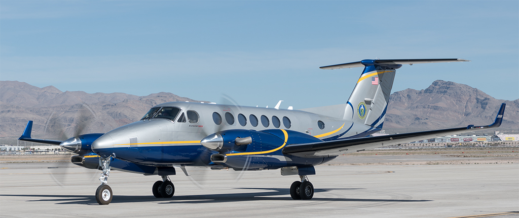
AMS provides responsive aerial measurements to detect, analyze, and track radioactive material before and during emergencies. AMS expanded mission includes:
- Providing initial data to RAP Teams and FRMAC
- Confirming National Atmospheric Release Advisory Capability predictive computer models
- Giving initial assessment of ground deposition
- Searching for lost radioactive sources or scattered fragments
- Providing preventive radionuclide detection
The Remote Sensing Laboratory is the only dedicated nuclear response aviation program in the world.
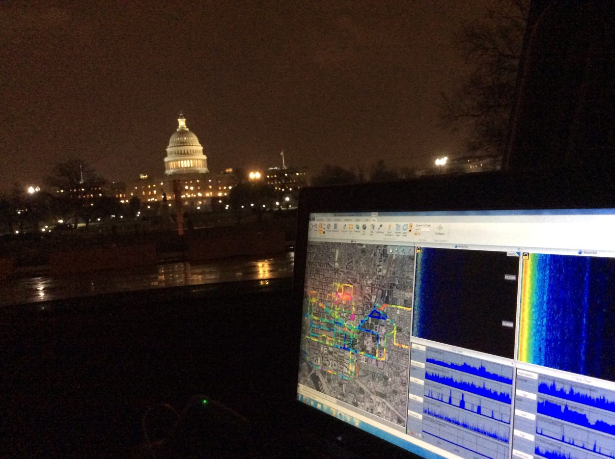
RSL can provide large-area radiological deposition and ground contamination mapping in the event of a radiological release. Algorithm research for image analysis of spectral imagery can be used to monitor environmental conditions, assess vegetation stress, and detect hard or buried targets, minefields, objects, or treaty-specific processing facilities. RSL remote sensing capabilities include:
- Radiation detection, monitoring, surveillance, and analysis
- High speed data telemetry
- Secure mobile communications
- Geographic Information Systems
- Photography and videography
Homeland Security and Counterterrorism Solutions
RSL supports the nation’s counterterrorism efforts with customized products and prototyping. With a focus on rapid turn-around and advanced-technology solutions, RSL specializes in unique technological disciplines in counterterrorism including:
- Special instruments for active and passive electromagnetic applications
- Nuclear, chemical, and biological detection systems
- Sensor development, testing and application verification
- Real-time mission support
RSL provides force and facility protection to U.S. domestic and international assets and activities. RSL subject matter experts conduct facility and site vulnerability assessments in order to design, install, and maintain facility early warning systems for nuclear/radiological, biological, and chemical weapons. RSL also does similar assessments and provides technical security on a temporary basis for specific events, such as the State of the Union Address and the Olympic Games.
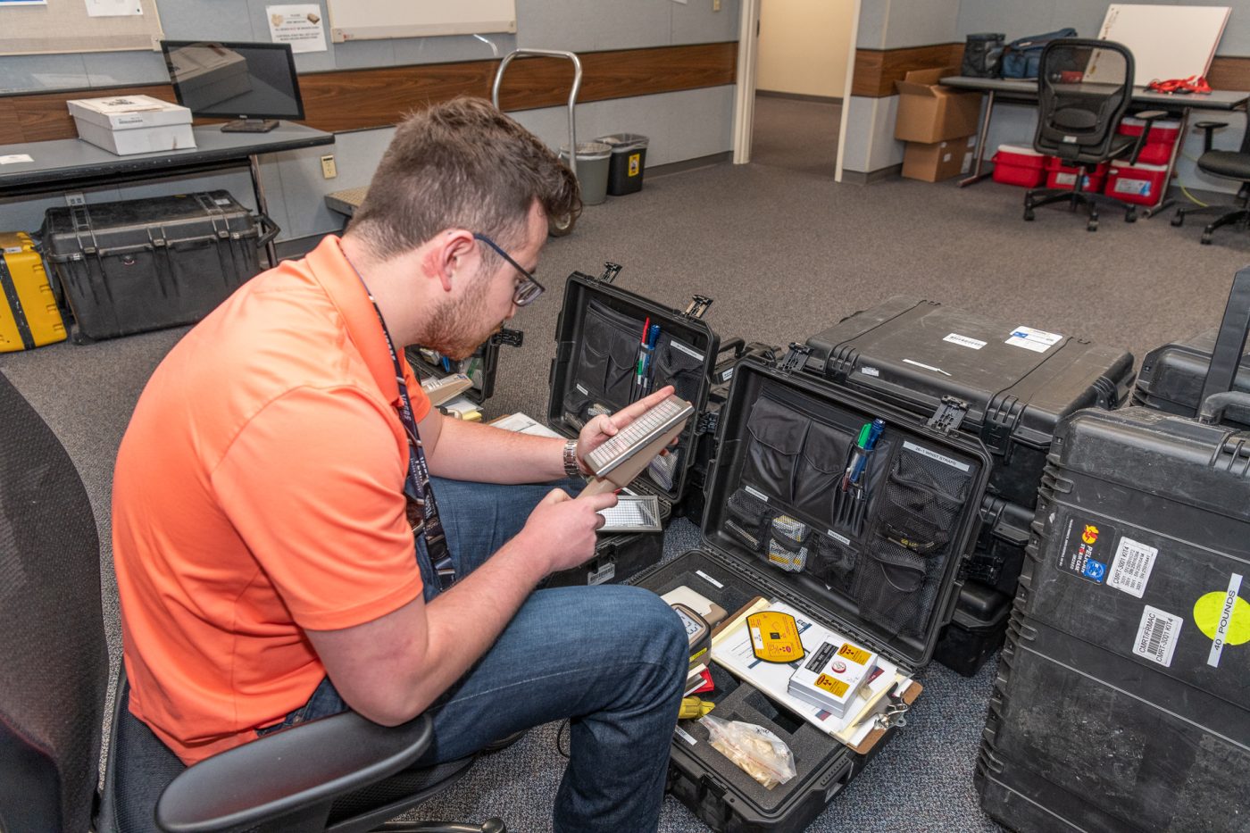
RSL Personnel and Technical Assets
RSL is comprised of engineers, technologists, pilots, operations specialists, administrators, and scientists — many of whom hold doctorate degrees — to provide a wide variety of education and experience. Working in sophisticated laboratories with state-of-the-art equipment, these personnel work to advance the technological and operational capabilities of the emergency response teams and other RSL customers.